
Alaska or Bust!
By Wendee Holtcamp
Originally published in April 1999 Historic Traveler Magazine
As we travel, we read about the pioneers who went before us throughout Canada and Alaska, in gold rushes and war-time construction. My husband reads aloud from the Milepost, the bible of north country travel, and I am fascinated to learn that the highway began as a rough dirt track carved through mountain and muskeg swamp by World War II soldiers and contracted civilians.
When the Japanese bombed Pearl Harbor in December 1941, the road's construction became a top military priority. With the permission of Canada, by May 1942, over 10,000 U.S. Army troops and 16,000 civilians poured into northern Canada and Alaska for construction, engineering, supervision and administration. The sparsely populated alpine wilderness quickly became inundated with soldiers and roaring bulldozers, an influx was akin to the Klondike gold rush of 1898.
All the planning and research that went into our trip was nothing compared to what the young soldiers endured to engineer this road. Just a couple of months after construction began, Japan invaded two of Alaska's Aleutian islands, and the task took on even greater urgency. The danger that the Japanese would invade Alaska became palpable. Working frantically, soldiers and civilians forged the Alaska Highway's entire length -- from Dawson Creek, British Columbia to Delta Junction, Alaska -- was forged in just eight months, twelve days. It's still considered one of the greatest engineering feats of history.
Today, the highway is fully paved -- barring patches of road construction, frost heaves and potholes. Frigid winters and subsequent spring thaws of the far north country cause asphalt to buckle into roller coaster-like hills and valleys, necessitating constant warm season road construction. Here on the highway's southern stretch, the smooth, unbuckled asphalt whirs beneath me, and a gentle rain begins to fall.
I can't see much beyond the immediate roadside because of the thick mist and gray clouds, but I start to notice white-barked birch trees intermingled with the lofty evergreens. The changing scenery reminds me of something I read in the memoirs of William Hoge, the Commanding General of the Alaska Highway Project. He tells of a crackerjack of a bush pilot that flew him up and down the planned highway route to scout for optimal paths through mountain ranges and over rivers. From his extensive surveillance, he discovered that spruce trees grew on mucky, soft muskeg swamp, cedars on gravelly soil, and birch and poplar on sandy soil. This information proved vital to the construction crews.
Outside of the tiny towns, the land along the Alaska Highway remains virtually uninhabited, as it was in 1942. “There were a lot of places where no one had been,” said Hoge in his memoirs. “I couldn’t even find an Indian who had been over parts of it.” Today, a handful of First Nations [Indian] People and scattered homesteaders live in remote locales, sometimes accessible to the outside world only through bush planes and snowmobiles. On the Highway itself, hundreds of miles pass with no billboards, no power lines, no police, and little traffic.
We pass a grove of dead trees standing in shallow water, sprinkled with newly fallen snow. Wind-worn, thin spruce trees surround the misty pond -- the first I’ve seen of the toothpick trees that dominate in the expansive ecological region known as taiga, or “the land of little sticks.” Taiga covers vast areas of northern Canada and Alaska. Two-year old Savannah points out the window, “Look mama, it’s Alaxa!” -- but our destination still lies days beyond.
It's peaceful watching the rain drizzle down on the untouched timberland, but the rain is slowing our pace. Partly to entertain the kids and with little hope, I sing, “Rain, rain go away, come again another day,” and miraculously it works. It starts snowing! Coming from southern California, I never in my wildest imagination expected snow on this late spring trip. The inclement weather throws a monkey wrench in our plans to camp along the way.
We stop for the night at the Pink Mountain Motor Inn at the 143 mile-mark of the Alaska Highway. The inn is a ramshackle getup reminiscent of the gold rush days, with fake wood siding and the aroma of cigarette smoke. Pink Mountain, with its ninety-nine citizens, is one of many blink-and-miss-it towns along the highway, consisting of but one or two inns that cater to travelers.
The next morning, the excitement at spotting wildlife balances the monotony of endless 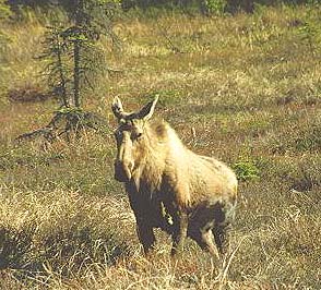 taiga and our kids growing frustration. Quaint road signs announcing Moose on Highway, and Watch for Caribou on Roadside predict their presence every time, as if we’re driving through an alpine safari park. Caribou graze along the roadside in groups of two or three. We pull over to watch them for a time, and one jaunts across the road with its characteristic bent-legged waltz. They are endearing animals, with gentle faces similar to young Jersey heifers.
The driving at times seems endless, and I ponder what it was like for the men who forged this path through the wilderness in both summer and frigid winter. I later learn that troops were at work 24 hours a day, seven days a week for the duration of the project. The military companies worked along the highway in 250-mile segments, spread out from Dawson Creek to Alaska. “When one of them completed its section, they would leap-frog ahead of the lead company and take over,” states General Hoge. They averaged over fourteen miles of new road a day.
“They left equipment running twenty-four hours a day, or they wouldn’t start in the cold,” says Raymond Anderson Jr., the surviving son of an Army veteran who worked vehicle maintenance on the Alaska Highway, as he remembers some of his father’s stories. “If they had to shut them off, they’d light fires under the engine.” Anderson maintains a large collection of his father’s wartime photos. His father said the fishing in the north was great, and he took many photos of his off-duty pastime. “Dad talked about how beautiful it was,” recalls Anderson. “Sometimes he talked about us pulling up stakes and moving to Alaska, but we never did.”
Like Anderson, we also have considered packing it all up and moving for good to Alaska, but for now, we’re satisfied with the experience of viewing the vastness of the North American continent.
After driving through Fort Nelson, Historical Mile 300, and former camp to 2,000 troops, the highway climbs out of the taiga and into the Stone Mountains, thick towers of bare grey rock. Taupe-colored bighorn stone sheep lick salt from the roadside. We pass over the highest point on the entire route at 4,250 feet.
We can’t resist a stop at the most picturesque lake I have ever seen - its teal-blue water broken up with geometrical slabs of melting ice. The northernmost Rocky Mountains, capped with snow, frame this Muncho Lake on all sides. I later learn that the road around the lake was particularly difficult to build because of its rocky banks and the surrounding mountains of stone. The soldiers hauled boatloads of stones across the lake.
Fifty years later, the highway through these parts still consists of many hairpin turns and treacherous road conditions. We wind our way through steep mountain passes, where a mere one-lane gravel road separates our car from a steep ravine. We lurch through potholes and careen over bumps. I laugh and think, “This is the road to Alaska!”
A few hours later, we stop at the town of Liard River, where we take a dip in the natural hot springs. A local tells me that the wartime soldiers used the lush oasis daily, and kindly allowed the women privacy in the springs once a week. The Liard Hotsprings is one of the most frequented spots along the highway today.
Back on the road, it’s not long before we spot a small sign marking our entry into Yukon Territory -- a name conjuring images of gold rush days and vast untamed wilderness. The highway crosses back and forth between British Columbia and Yukon six times over a hundred miles, with grisly stretches of road construction that slow our pace to a crawl. Gravelly mud creates a thick coat of salty sludge on our car, and wayward pebbles nick our windshield. Orange-bedecked construction workers guide us through one lane of traffic, after we wait fifteen minutes for traffic from the other direction.
In the summer of 1942, the original construction workers faced adversity of another kind -- hordes of mosquitos. “You had to eat with your head net on,” reports General Hoge, “you would raise the head net, and by the time you got food up to your mouth it would be covered with mosquitos.” The food itself was nothing to rave about. “It was the poorest food I’ve ever eaten in the Army,” said Carl K. Lindley, an Army Engineer who worked on the highway’s construction, and later went on to combat in Europe.
Lindley is an historic figure in his own right, having started one of the most popular tourist attractions along today’s Alaska Highway. Private Lindley, serving with the 341st Engineers, got both his feet run over by a dump truck. While recovering from his foot injury in Yukon’s Watson Creek, he was assigned to repair a damaged signpost that stated the distance to various points along the pioneer highway. He decided to add his own hometown -- Danville, Illinois, 2,835 miles -- to the sign. Lindley’s simple act started a tradition that has created Watson Lake’s renowned Signpost Forest, at last count boasting over 40,000 signs gleaned from around the world. The signs range from license plates to street signs to a six-by-ten foot German autobahn sign. Visitors are welcomed to add their own sign to the ever-growing collection.
On the 50th anniversary of the Alaska Highway in 1992, the Yukon and Canadian governments paid for Lindley and his wife Elinor to return to Watson Lake for a reunion of all Alaska Highway veterans. He was greeted at the airport by the Canadian Royal Mounted Police and showered with gifts. An artists’ rendition of an old photograph of Lindley on the original highway graces the local elementary school. To Watson Lake, the “lonely GI who started the Signpost Forest” deserved a hero’s welcome.
We camp for the night at a private campground just south of Whitehorse. The air is crisp and the golden sun dips barely below the horizon for a couple hours. Penned up sled dogs howl and bark in the night, but we snuggle together, ourselves like a pack of wolves.
In the morning we drive on toward Whitehorse. Its notoriety comes not from its time as the western Alaska Highway headquarters, but from Klondike gold rush days, when stampeders poured into the region to take their chance at finding gold upstream. Starting in 1898, river sternwheelers plied the north-flowing Yukon River, which runs through Whitehorse, along with the makeshift gold prospectors’ boats. In 1942, the town was once again inundated with men, this time American soldiers.
According to John Horne, an Army veteran who worked at headquarters in Whitehorse, life was far from idyllic. The loneliness, extreme cold, poor food, primitive latrines, and sometimes inept workers caused countless calamities. “Some of the lower ranking support personnel were disruptive troublemakers who had been kicked out of combat unit during training,” recalls Horne. “My rating, at age 19, forced me into responsibility for some of these misfits, in a half-empty, uncompleted barracks, with no doors or windows."
Living conditions at headquarters weren’t any more pleasant than life on the road. “The only latrine available to me was a mile away in the woods, and the toilet seat was a long plank covered with frozen urine,” recalls Horne. The cold winter months lent a harsh edge of reality to the alpine scenery.
Beyond Whitehorse, the landscape changes. The glaciated peaks of Kluane National Park rise to 19,000 feet in the distance. The mountains are spectacular - carved by glaciers, yet softened by time. And they go on for miles, range upon range, unlike the singular strand of peaks seen elsewhere on our journey.
When the construction crews reached this far north, they encountered something new and unexpected: permafrost. According to General Hoge, it threw a loop to their construction methods. “I remember there was a spot where I had the road and everything was all right, then I went back over it and it was all full of water, and muddy,” recalls Hoge. “I couldn’t understand because it had been dry before.” He soon learned that the sun shining on the tree-stripped road would cause the otherwise permanently frozen ground to melt on top and seep water. “The only thing to do was to cut the timber and then make a mat of timber and branches.” The men would then cover the fallen trees with dirt, and that was their pioneer road through the permafrost.
We drive and stop, drive and stop, for hours upon hours, days upon days, through permafrost and taiga, through mountains and over rivers. I start to wonder if we are delusional, and we will never really make it to Alaska, when suddenly I spot a sign pointing the way to American customs. Seven days from Los Angeles, and three long days on the Alaska Highway, and we finally have made it to the last American frontier. A few miles beyond customs, we are graced by the roadside presence of a lumbering black bear, as if welcoming us back into the States.
There are still over 200 miles to the final highway milepost at the little-known Alaska town of Delta Junction. At the time the highway was built, another road already connected Delta Junction to the capital of Fairbanks, where most traffic along the new highway would be headed. As for us, we angle south at the town of Tok, just shy of Delta Junction. Only another eighteen hours to get to our final destination: the Kenai peninsula. After all, Alaska is over twice the size of Yukon Territory.
In the fifty-seven years since the Alaska Highway was first carved through timber and taiga, things have changed greatly. “The first thing I thought when getting off the plane was, ‘Where did all the trees go?’” said Carl Lindley about his return to the region in 1992. Lindley’s reaction was quite different than mine. I saw trees, an abundance of trees even. I saw uninhabited, largely unexplored wilderness. But then I never saw the virgin forestland that was razed by tractors and dozers to clear the way for this wilderness road, and subsequently thinned to make room for growing towns along the highway. The land is quiet and peaceful once again, yet modernization has reached the far north.
After the road was forged from one end to another, it was ‘improved’ during 1943. Since then, it has been one continual road construction project -- cutting out sections of sharp turns and steep grades, surfacing with asphalt and resurfacing frost heaves. In 1946, after the war was over, the U.S. turned the Canadian portion of the Alaska Highway over to their government. It was opened to civilian traffic in 1948, hailing a new era of commerce to Alaska, including the advent of tourist travel. To cater to both truckers and tourists, inns and restaurants sprouted up along the highway’s length. It allowed Alaska to become more unified with the rest of the modernized United States and Canada, for better or worse. What was once a pioneer gravel road, is now a land link connecting one era to another.
TRIP PLANNER
NOTE: This information is from 1999 and may be outdated.
GETTING THERE
There are two main access routes to the Alaska Highway, the East and West Route, both mapped and detailed in The Milepost, considered the ‘bible’ of North Country travel. The Milepost is a mile by mile guide to lodging, dining, camping, and attractions along the Alaska Highway and other roads throughout Alaska and Western Canada. The guide costs $21.95 and can be ordered from Vernon Publications, 619 E. Ship Creek Ave., Suite. 329, Anchorage, AK, 99501. Or, call 800 726 4707 or order online at their web site: http://www.themilepost.com/. The East Access Route to the Alaska Highway enters Canada through Alberta from Montana, north to Edmonton and west to Dawson Creek. The West Access Route comes north from Washington into British Columbia, heading north to Dawson Creek. The routes are both complicated, with several highway changes, and it is highly recommended you follow the Milepost maps, with the routes highlighted in red!
LODGING AND DINING
Dawson Creek: Try the Trail Inn at 1748 Alaska Ave. ($69-$81), the Alaska Hotel Cafe & Pub at 10209 S 10th Street. (Starting at $25) or the Northern Lights RV Park at Mile 1.5 Highway 97 (Alaska Highway) South. Fort Nelson: The Bluebell Inn at 3907 50th Avenue South (Mile 299) has a restaurant, a laundromat, and air-conditioned rooms with kitchenettes. Highland Glen Lodge in the Canadian Rockies is a log cabin on Muncho Lake, specializing in fly-in fishing trips. Trapper Ray’s Liard Hotsprings Lodge ($75) at Mile 497, Alaska Highway has a log lodge, RV and tent sites. Watson Lake: The Big Horn Hotel ($69-85) prides itself on friendly service and beautiful rooms, and is located across from Wye Park on the Alaska Highway. Whitehorse: The High Country Inn ($89-$199) has unique rooms and suites, a popular local restaurant/bar called the Yukon Mining Company Saloon, and a prime location near Main Street. The Historical House Bed & Breakfast ($75-$85) at the corner of Fifth and Wood is an authentic Yukon Heritage Home. Tok: WinterCabin Bed and Breakfast ($60-$80) is run by writer and Alaska homesteader Donna Blasor Bernhardt, who spent one frigid winter in a tent with her family before their cabin as built.
THINGS TO DO
In Dawson Creek the Visitor Infocentre offers a self-guided historical walking tour, and a museum that contains pioneer artifacts and information about the highway construction. The Walter Wright Pioneer Village has nine gardens and several pioneer buildings. The Fort Nelson Heritage Museum has pioneer artifacts and displays on Alaska Highway history and area wildlife. The Fort Nelson-Liard Native Friendship Centre on 49th Avenue in Fort Nelson exhibits native crafts. Besides the famous Signpost Forest, Watson Creek has a Northern Lights Centre that uses lasers and video to recreate an indoor panorama of the aurora borealis. In Whitehorse, visit the SS Klondike National Historic Site, a retired sternwheeler sitting beside the Yukon River. Also in Whitehorse the Yukon Transportation Museum displays ships, planes, railroad, dogsleds and vintage vehicles. Historical walking tours through Whitehorse are available from the Yukon Historical & Museums Association. Tok, Alaska just shy of Delta Junction has a huge log building Visitor Center with excellent displays about the local ecology and history, and trip planning information.
VISITOR INFORMATION
Tourist information about the Alaska Highway and the regions it spans can be obtained from Tourism Yukon, 403-667-5340, or at http://www.touryukon.com; or Super, Natural British Columbia at 1-800-663-6000 or http://travel.bc.ca; and Alaska Visitors Association at 907 561 5733, or http://www.alaskanet.com/visitalaska/.
TIPS
Most vehicles can traverse the Alaska Highway with no special requirements except that it be well-serviced before the trip with a full spare tire, not a ‘donut.’ Some travelers prefer to bring a spare gas can, though 100 miles is the longest stretch between gas stations (and food, lodging). Most gas stations are not open at night, so plan accordingly. Gravel segments are treated with calcium chloride, which corrodes paint, so wash your vehicle when you get to your destination, but don’t expect to find a carwash along the way. Mileage and speed limits are in kilometres in Canada (1km=0.6 mile). Get a Canadian Nonresident Interprovincial Motor Vehicle Liability Insurance Card from your auto insurance agent. Although virtually all Canadian vendors accept U.S. money, you’ll get a better exchange rate if you switch money at banks. At customs you will be required to have proof of citizenship - either a Passport or birth certificate. Driver’s licenses are not sufficient. Drive with your headlights on at all times; in Canada it’s the law.
Text Copyright © 1999 Wendee Holtcamp
Photos Copyright © 2000 Matt & Wendee Holtcamp
bohemian@wendeeholtcamp.com
~**~**~**~**~
www.wendeeholtcamp.com
Copyright © 2000-2005 Wendee Holtcamp